




1. How high is Fansipan and why does its altitude matter?
How high is Fansipan? Fansipan stands at 3,143 metres above sea level, making it the highest mountain in Vietnam and one of the most prominent peaks in the Hoang Lien Son mountain range. Located near Sapa in Lao Cai Province, the mountain has long attracted travellers who want to experience the dramatic landscapes of northern Vietnam from a high-altitude perspective.
The altitude of 3,143 metres gives Fansipan a very different environment from Sapa town, which sits considerably lower in the valley. As visitors travel upward, the scenery gradually changes from green valleys and terraced fields to steep mountain slopes, dense vegetation and cooler high-altitude landscapes. This change in elevation is one of the defining features of a Fansipan journey. Fansipan is also part of the wider Hoang Lien Son range, an important mountainous area in northern Vietnam. The mountain landscape is characterised by rugged terrain, forests, valleys and constantly changing weather. On clear days, visitors can look across the surrounding peaks and valleys, while clouds and mist can create an entirely different atmosphere around the summit.
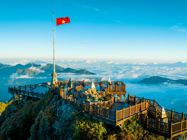
The summit of Fansipan stands at an altitude of over 3,000 meters (Source: Collected)
For international travellers, understanding Fansipan's altitude is useful when planning a visit. The higher elevation means temperatures can be noticeably cooler than in Sapa town, particularly near the summit. Weather conditions may also change quickly, so visitors should prepare with suitable clothing, comfortable footwear and enough time for a relaxed mountain experience. Today, reaching 3,143 metres does not necessarily require a long multi-day trek. The Fansipan cable car provides an accessible way to ascend from the Hoang Lien area towards the summit, allowing visitors to experience the dramatic change in elevation within a relatively short journey. Travellers can then continue on foot through the summit area and explore the surrounding viewpoints, spiritual landmarks and mountain pathways.
The altitude is ultimately more than just a number on a map. It shapes Fansipan's climate, vegetation, scenery and sense of place, making the mountain distinctly different from destinations at lower elevations. For anyone wondering how high is Fansipan, the answer of 3,143 metres also explains why reaching its summit feels like entering a completely different landscape above the clouds.
2. What to expect at Fansipan’s altitude
2.1 How the landscape changes as you ascend
One of the most noticeable aspects of Fansipan is how quickly the landscape changes with elevation. Starting from Sapa, travellers gradually move away from the valley landscape of rice terraces, villages and green hills towards the steeper terrain of the Hoang Lien Son range. The higher the journey goes, the more dramatic the surrounding mountain scenery becomes.
Near the upper sections of Fansipan, the landscape takes on a distinctly alpine character. Dense vegetation, rocky slopes, clouds and exposed mountain areas create a setting that feels very different from the warmer valleys below. During periods of clear weather, the changing elevation also provides increasingly wide views across the surrounding mountains.
This transition makes the journey itself an important part of the experience. Rather than seeing the summit as an isolated point, visitors can observe how the natural environment changes along the way and better understand what makes Fansipan's 3,143-metre altitude so distinctive.
2.2 How cold is Fansipan compared with Sapa?
Because of its elevation, Fansipan is generally cooler than Sapa town, particularly around the summit. Temperatures can feel noticeably lower when visitors arrive at the upper mountain area, while strong winds and mist may make the conditions feel colder than the actual temperature suggests.
Weather conditions can also change quickly at high altitude. A clear view may be replaced by clouds or mist within a short period, while sunlight can return later in the day. These changes are part of the character of Fansipan and can give the mountain a different appearance from one visit to another.
Travellers should therefore bring a light or warm jacket even when the weather in Sapa town feels comfortable. Comfortable shoes, an additional layer and rain protection are also useful, especially for visitors planning to spend time walking around the summit and spiritual complex.
2.3 What can you see from 3,143 metres?
When visibility is good, the summit of Fansipan offers expansive views of the Hoang Lien Son mountain landscape. Looking down from the upper sections, visitors can see layers of mountains and valleys stretching across northern Vietnam, creating a strong sense of scale.
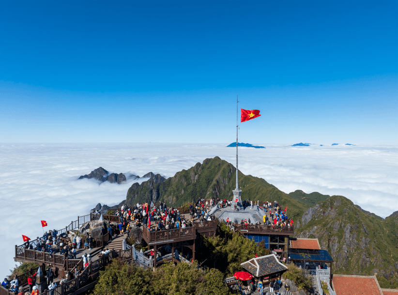
Visitors can admire the majestic nature of the Northwest from the summit of Fansipan (Source: Collected)
Clouds are also an important part of the scenery. At times, the summit can appear to rise above a sea of clouds, while mist may partially cover the surrounding mountains. This constantly changing atmosphere is one reason photographs taken at Fansipan can look very different depending on the season and time of day.
The views are not guaranteed, however. Fog, cloud cover and weather conditions may limit visibility even after visitors have made the journey to the summit. For this reason, the experience of Fansipan should be appreciated as much for its high-altitude atmosphere and architecture as for panoramic views alone.
2.4 Does the altitude make Fansipan difficult to visit?
The answer depends on how visitors choose to reach the summit. Fansipan can be approached through trekking routes, but travellers who prefer a more accessible option can take the cable car towards the summit area. This significantly reduces the physical effort required compared with a long mountain trek.
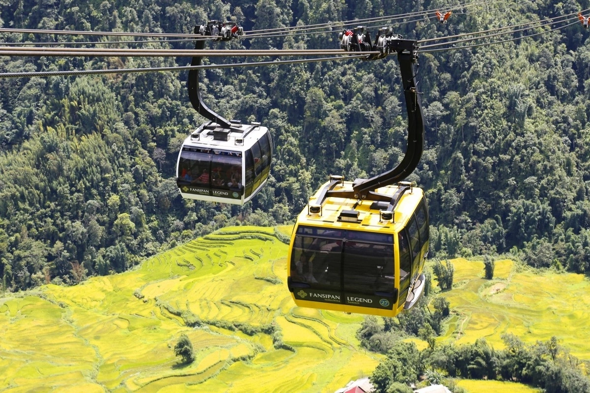
A modern cable car system allows visitors to easily conquer the summit of Fansipan (Source: Collected)
Even when using the cable car, visitors should remember that they are arriving at an altitude of 3,143 metres. Walking around the summit area involves stone paths and stairways, so taking a steady pace and allowing time to rest can make the experience more comfortable.
Travellers who are not accustomed to high-altitude environments should also pay attention to how they feel after reaching the upper mountain area. Staying hydrated, avoiding unnecessary rushing and taking breaks can help visitors enjoy the summit experience at a comfortable pace.
2.5 How does Fansipan’s altitude shape the experience?
The altitude of Fansipan influences almost every aspect of the journey, from the temperature and vegetation to the clouds and mountain views. It is what creates the dramatic contrast between Sapa's valley environment and the summit landscape several kilometres higher above sea level.
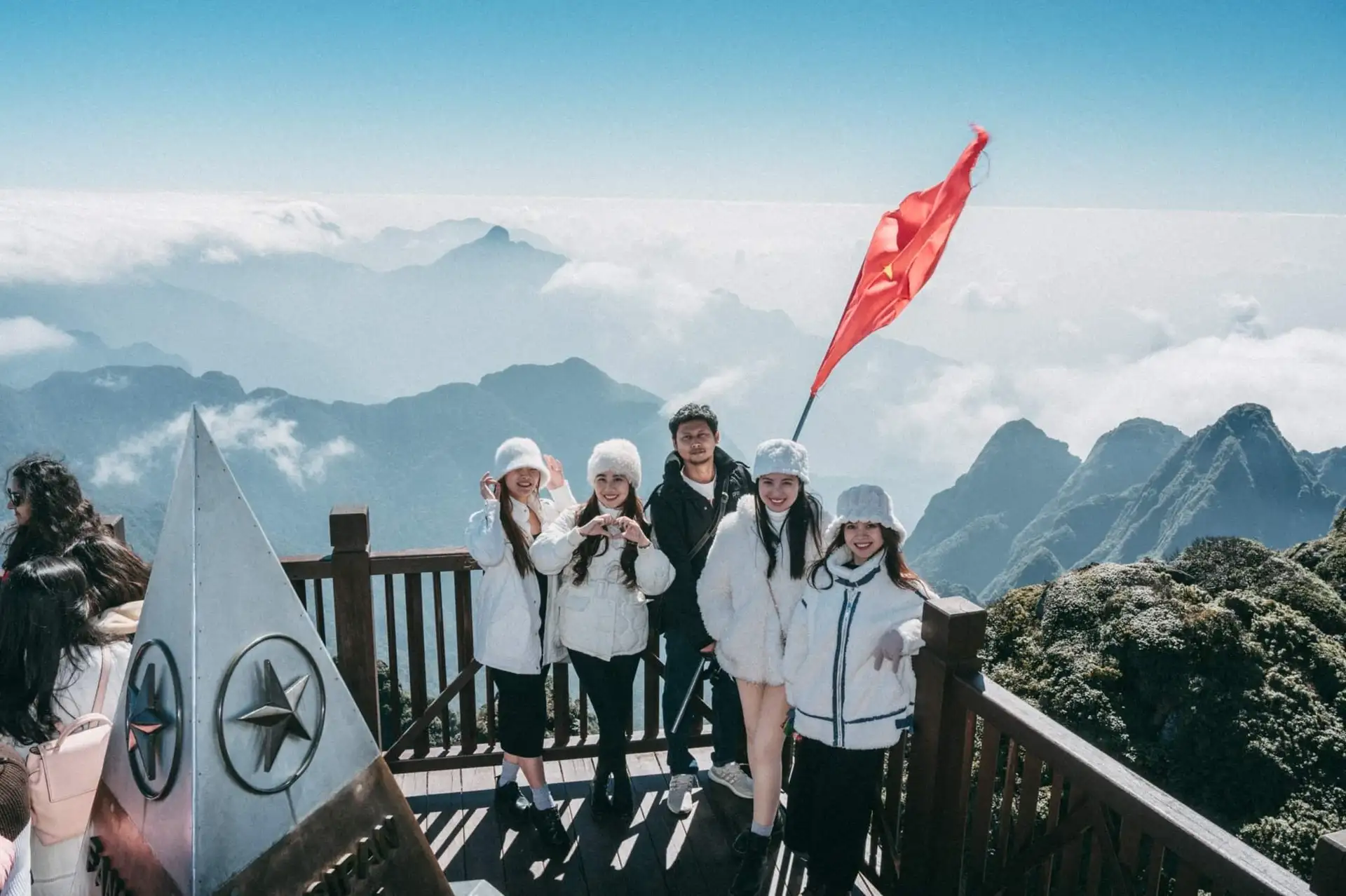
Visitors delighted after conquering a height of 3,000 meters (Source: Collected)
At the top, the combination of mountain architecture, Buddhist landmarks, rocky pathways and surrounding clouds creates an atmosphere that is difficult to reproduce at lower elevations. Visitors can explore the spiritual complex, walk towards the summit and pause at viewpoints while experiencing the distinctive environment of the Hoang Lien Son range.
Understanding how high is Fansipan therefore provides useful context for the entire journey. The figure of 3,143 metres explains not only why Fansipan is Vietnam's highest mountain, but also why its climate, scenery and visitor experience are so different from those found in Sapa town.
3. How to prepare for a visit to Fansipan
3.1 Choose the right way to reach the summit
For most international visitors, the cable car is the most convenient way to experience Fansipan without committing to a long mountain trek. The journey begins around the Hoang Lien area and gradually takes passengers towards the upper mountain, offering views of forests, valleys and the Hoang Lien Son range along the way.
The cable car also makes it possible to explore Fansipan within a day while leaving enough time for the summit area and surrounding attractions. After reaching the upper station, visitors can continue through the stone pathways and stairways towards the spiritual complex and the 3,143-metre summit.
Travellers interested in trekking can consider a longer hiking experience instead. However, this requires considerably more preparation, physical effort and time. The choice should therefore depend on the traveller's experience, available time and preferred way of exploring the mountain.
3.2 Prepare suitable clothing for the altitude
The weather at 3,143 metres can be considerably cooler than in Sapa town, so clothing should be chosen with the mountain environment in mind. Layers are particularly useful because visitors can adjust what they wear as temperatures and weather conditions change throughout the journey.
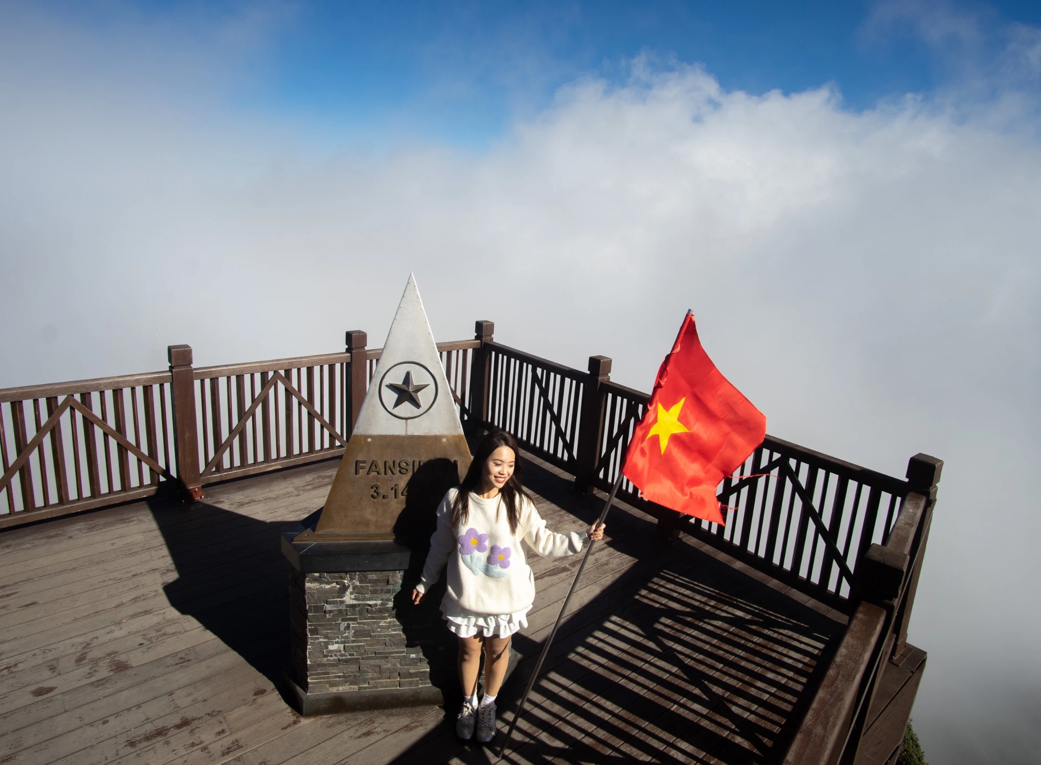
Comfortable and lightweight clothing makes the journey of conquest easier for travelers (Source: Collected)
A warm outer layer is useful even when the weather in Sapa feels mild. Comfortable walking shoes are equally important because exploring the summit area and spiritual complex involves stone paths and stairways.
Rain protection is also worth carrying, especially during periods when clouds and mist are more common. A compact raincoat or waterproof layer can make the experience more comfortable if weather conditions change unexpectedly.
3.3 Allow enough time for the summit experience
Reaching the summit is only one part of a Fansipan visit. The upper mountain area includes spiritual landmarks, Buddhist statues, stone pathways and viewpoints, so travellers should avoid planning their schedule too tightly.
Allowing additional time also makes it easier to adapt to changing weather. If clouds temporarily reduce visibility, visitors can explore the architectural and cultural attractions before returning to viewpoints when conditions improve.
A relaxed schedule is particularly useful for international travellers who want to combine Fansipan with other Sapa experiences. Depending on the itinerary, the mountain journey can be paired with the Muong Hoa mountain train, May Village or an evening in Sapa town.
3.4 Check the weather before travelling
Weather can have a major influence on the Fansipan experience. Clear conditions may provide broad mountain views, while clouds and mist can reduce visibility around the summit. Checking the forecast before setting out helps travellers choose appropriate clothing and plan their time more realistically.
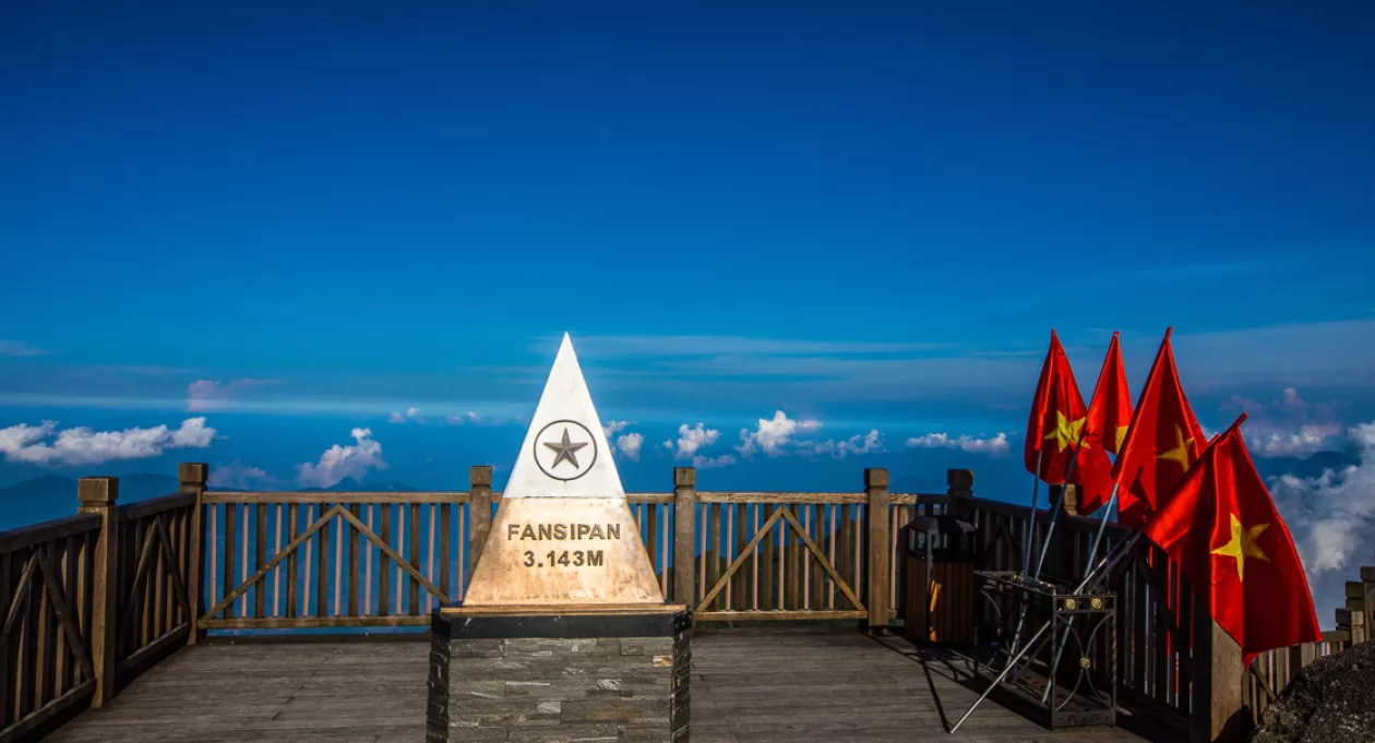
Travelers should check the weather forecast before their trip to ensure the best possible experience (Source: Collected)
However, mountain weather can change quickly, so even a favourable forecast does not guarantee clear views throughout the entire visit. Visitors should be prepared for changing conditions and avoid judging the experience only by whether the summit is completely clear.
The changing weather is also part of Fansipan's character. Mist drifting across the stone architecture, clouds surrounding the mountain and moments of clear sunlight can create very different impressions of the same landscape.
3.5 Combine Fansipan with a wider Sapa itinerary
Understanding how high is Fansipan can help travellers build a more balanced itinerary. Since the summit experience focuses on mountain scenery, architecture and spirituality, it can be combined with lower-altitude cultural experiences around Sapa for greater variety.
May Village is one option for discovering Northwest ethnic culture through traditional houses, costumes, handicrafts, performances and local cuisine. The Muong Hoa Valley and nearby villages such as Lao Chai and Ta Van offer another perspective through terraced landscapes and local community life.
A well-planned journey can therefore connect several layers of northern Vietnam in one trip: Sapa town in the valley, Muong Hoa and its villages, the cultural atmosphere of May Village, and finally Fansipan at 3,143 metres. This combination allows visitors to understand not only how high Fansipan is, but also how its altitude shapes the landscape and experience of the destination.
So, how high is Fansipan? The answer is 3,143 metres above sea level, an elevation that shapes the mountain’s distinctive climate, landscape and travel experience. With the cable car making the summit more accessible, visitors can explore the spiritual complex, mountain pathways and viewpoints without undertaking a long trek. By preparing for cooler weather and allowing enough time to explore, travellers can make the most of their journey to Vietnam’s highest peak.


