


With its stunning landscapes and unique culture, Sapa offers a range of attractions, from the breathtaking Fansipan Mountain to the charming ethnic villages. This Sapa Vietnam map will help you navigate through the winding roads and trails, ensuring you won't miss any of the must-see sights.
1. What makes a Sapa Vietnam map more than a map
A Sapa Vietnam map is often seen as a simple navigation tool, but in reality, it functions more like a curated guide to the region’s most remarkable experiences. Instead of just showing routes and distances, it helps travelers visualize how different landscapes, villages, and attractions connect to form a complete journey.
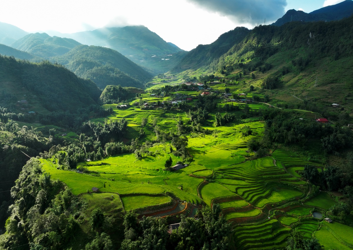
Sapa reveals layered mountains, valleys, and clouds in one landscape. (Photo: Collected)
In a destination like Sapa, where mountains, valleys, and cultural communities are closely intertwined, understanding this “map of experiences” becomes essential. Each location is not just a point on the map, but part of a larger story shaped by nature and local life. From the high peaks of Fansipan to the terraced fields of Muong Hoa Valley, every route reveals a different layer of Sapa.

From Fansipan peak to valleys, Sapa unfolds in every direction. (Photo: Collected)
Using a Sapa Vietnam map in this way allows travelers to move beyond checklist tourism. It encourages a more intentional approach, where each stop is chosen for how it contributes to the overall experience. Whether it is the vibrant atmosphere of Sapa Town or the quieter rhythm of nearby villages, the journey becomes more cohesive and meaningful when guided by a well-structured map.
2. The iconic highlights on a Sapa Vietnam map
A well-curated Sapa Vietnam map always begins with the destinations that define the region’s identity. These are the places where landscapes, culture, and experiences come together most vividly, creating the foundation for any journey through Sapa.
2.1 Fansipan – The rooftop of Indochina
On any thoughtfully curated Sapa Vietnam map, Fansipan is the destination that immediately commands attention. Standing at 3,143 meters above sea level, it is the highest peak in Indochina and one of the defining symbols of Sapa. Yet what makes Fansipan so compelling is not simply the summit itself, but the layered journey that unfolds from the moment visitors begin the ascent.
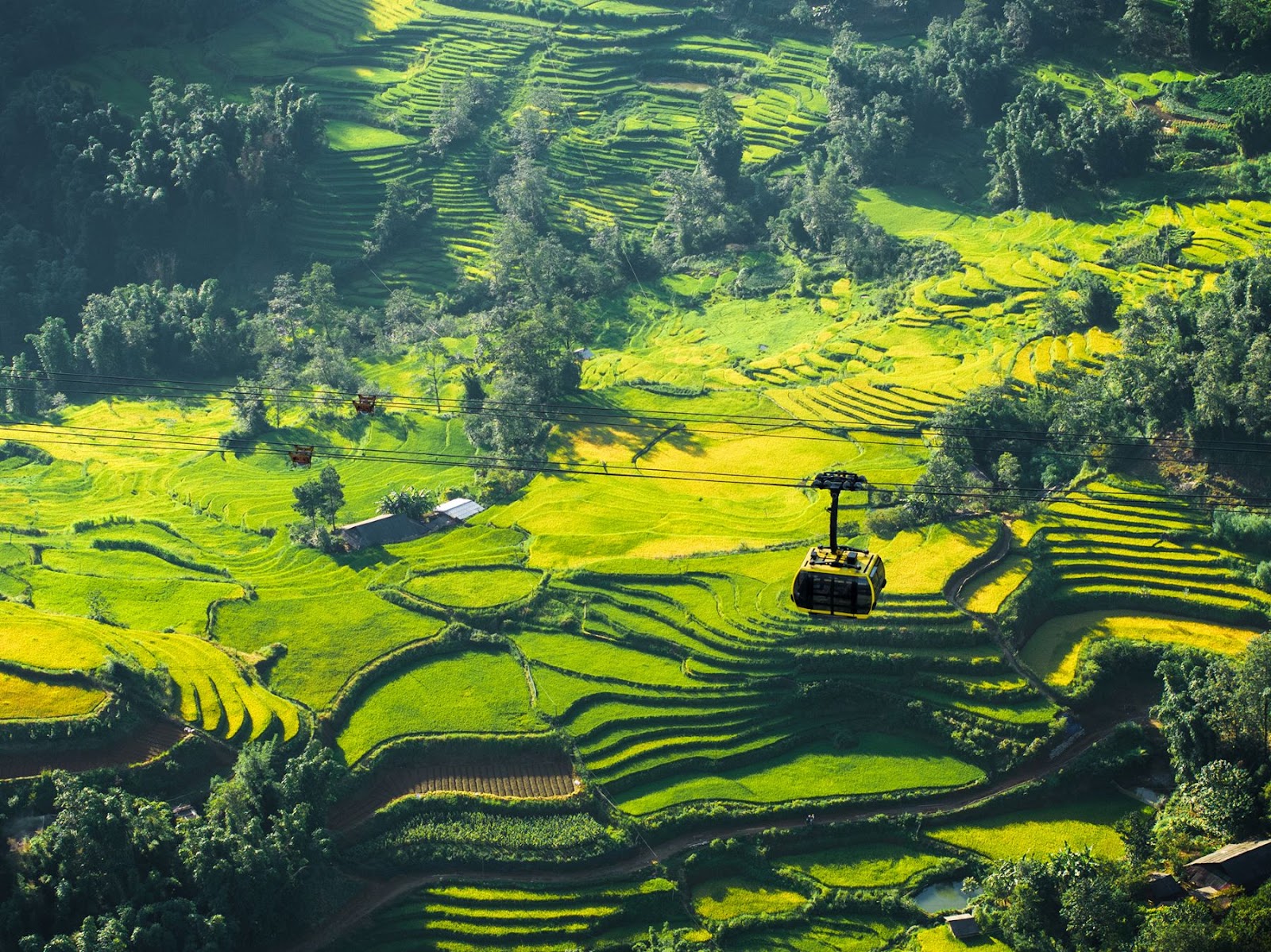
The cable car journey reveals Sapa’s mountains from above. (Photo: Collected)
The experience starts with the cable car at Sun World Fansipan Legend, where the movement from the valley floor to the mountain heights becomes an attraction in its own right. As the cabin glides above forests, deep ravines, and the undulating ridges of the Hoang Lien Son range, the scenery shifts constantly with the mountain weather.
On clear days, the panorama stretches dramatically across overlapping peaks. On mistier days, the landscape feels dreamlike, with clouds drifting so close they seem within reach. For many travelers using a Sapa Vietnam map to shape their itinerary, this is one of the most memorable stages of the journey, and you can easily secure your cable car tickets in advance, even before reaching the station. This is often a practical step, especially during peak seasons and major festivals.
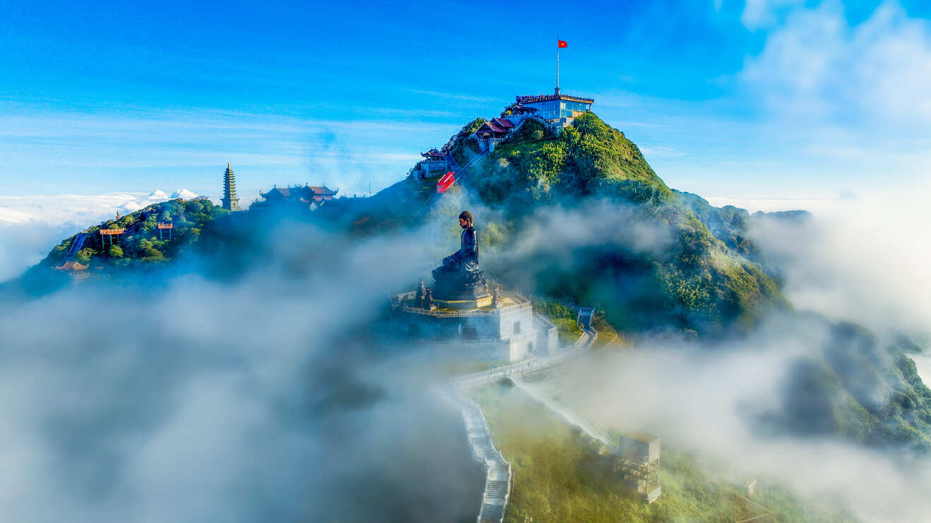
Fansipan rises as the highest peak in Indochina at 3,143 meters. (Photo: Collected)
Upon reaching the upper station, the atmosphere shifts into something quieter and more contemplative. Here begins a vast spiritual complex inspired by classical Vietnamese architecture of the Tran Dynasty, often described as a “Zen path in the clouds.” Stone pathways and staircases guide visitors through layers of sacred spaces, each unfolding gradually within a landscape of mist, wind, and mountain silence.

The spiritual complex forms a “Zen path in the clouds” at Fansipan. (Photo: Collected)
At the heart of this complex stands the Great Buddha Statue, rising 21.5 meters and recognized as the tallest bronze Buddha statue in Vietnam. Emerging through the clouds, it creates a striking visual presence that feels both monumental and serene. Nearby, the Arhat Path features 18 bronze Arhat statues aligned along the mountainside, their stillness reinforcing the contemplative atmosphere of the ascent.

The Great Buddha stands as the tallest bronze Buddha in Vietnam at Fansipan. (Photo: Collected)
Further along, the graceful statue of Avalokiteshvara Bodhisattva (Quan Am) and the serene Kim Son Bao Thang Pagoda introduce a softer, more meditative dimension to the journey. Together, these sacred landmarks transform Fansipan from a natural peak into a space where spirituality and landscape are deeply intertwined.

The Avalokiteshvara Bodhisattva statue adds a calm, spiritual presence. (Photo: Collected)
The experience continues to unfold through both movement and pause. Dining options at different elevations add another layer to the journey. At the base station, Van Sam restaurant offers a large buffet featuring a wide range of traditional Vietnamese dishes, including regional specialties such as grilled mountain pork and five-colored sticky rice. Higher up, a visit to Starbucks at 3,063 meters presents a surprising contrast. Often noted as one of the highest Starbucks locations in Asia, it offers a warm, modern space where visitors can sit with a hot drink while looking out over jagged peaks and a shifting sea of clouds.

Starbucks at Fansipan offers coffee with highland mountain views. (Photo: Collected)
To reach the highest point of Indochina, travelers make one final choice. Some continue on foot, climbing approximately 600 stone steps through the spiritual complex, allowing for a gradual and reflective ascent. Others opt for the Do Quyen peak funicular, a short but steep ride that brings them closer to the summit area, where the national flagpole and the stainless steel summit marker stand at 3,143 meters. Each option offers a different rhythm, one emphasizing immersion, the other efficiency, yet both leading to the same moment of arrival.

The Do Quyen funicular carries visitors closer to the summit. (Photo: Collected)
Near the summit, the flag-raising ceremony at the Grand Flagpole is among the most moving experiences on the mountain. Typically held in the early morning, it unfolds with the national anthem echoing through the high-altitude air as the flag rises against a backdrop of drifting clouds. For many visitors, this moment carries a quiet emotional weight, transforming the journey into something more than a scenic excursion.

The flagpole rises above clouds at Fansipan peak. (Photo: Collected)
Within the broader Sapa Vietnam map, Fansipan stands as more than a destination. It is a complete journey in itself, where altitude, culture, architecture, and emotion come together, shaping one of the most memorable experiences in northern Vietnam.
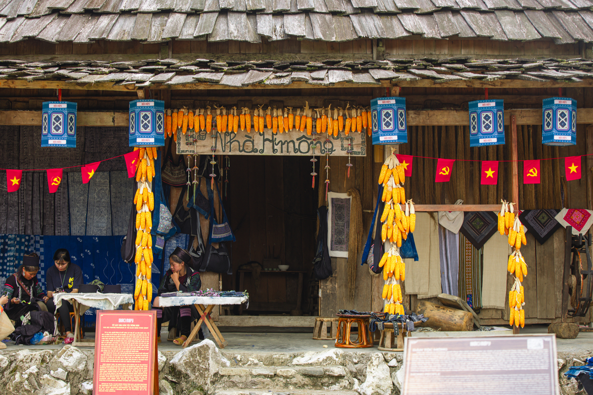
2.2 May Village – Breath in the cultural soul of Sapa
Within a thoughtfully curated Sapa Vietnam map, May Village emerges as a space where culture takes center stage. If Fansipan represents the dramatic scale of nature, then May Village offers a more grounded, human perspective, allowing travelers to step into the cultural fabric that defines Sapa beyond its landscapes.
May Village brings together the cultures of Sapa’s ethnic communities. (Photo: Collected)
Located within the Fansipan area, May Village is designed as an open cultural complex that brings together the traditions of seven ethnic groups, including the Hmong, Dao, Tay, Giay, Xa Pho, Ha Nhi, and others native to the northern highlands. Rather than presenting culture through static displays, the village unfolds as a living environment, where architecture, crafts, and daily life are closely connected to the surrounding terrain. Wooden houses, terraced layouts, and winding paths mirror the structure of real mountain communities, creating a sense of authenticity that feels immersive rather than staged.
Each corner of May Village reflects the diversity of northern ethnic groups. (Photo: Collected)
The atmosphere here is defined by subtle details. Traditional textiles drying in the open air, the sound of handmade instruments, and the presence of artisans working on embroidery or craftwork all contribute to a rhythm that feels unhurried and natural. Visitors are not simply observing culture from a distance but moving through it, experiencing how different ethnic identities coexist and shape the character of Sapa.
May Village offers a closer look at daily life in Sapa’s highlands. (Photo: Collected)
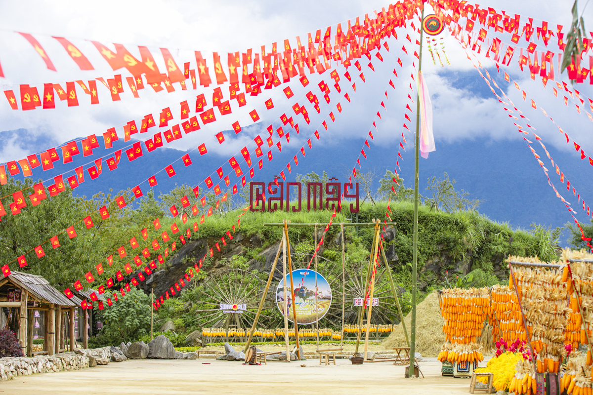
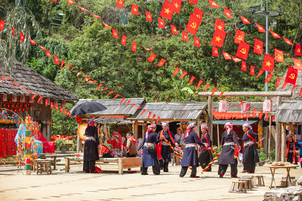
Seasonal festivals play an important role in bringing May Village to life. Throughout the year, cultural events, traditional performances, and ritual reenactments reflect the diversity of local heritage. These gatherings often combine music, dance, and community activities, offering a deeper understanding of how traditions are preserved and adapted over time. Depending on the season, the village can shift from a quiet cultural space to a vibrant setting filled with color, sound, and interaction.
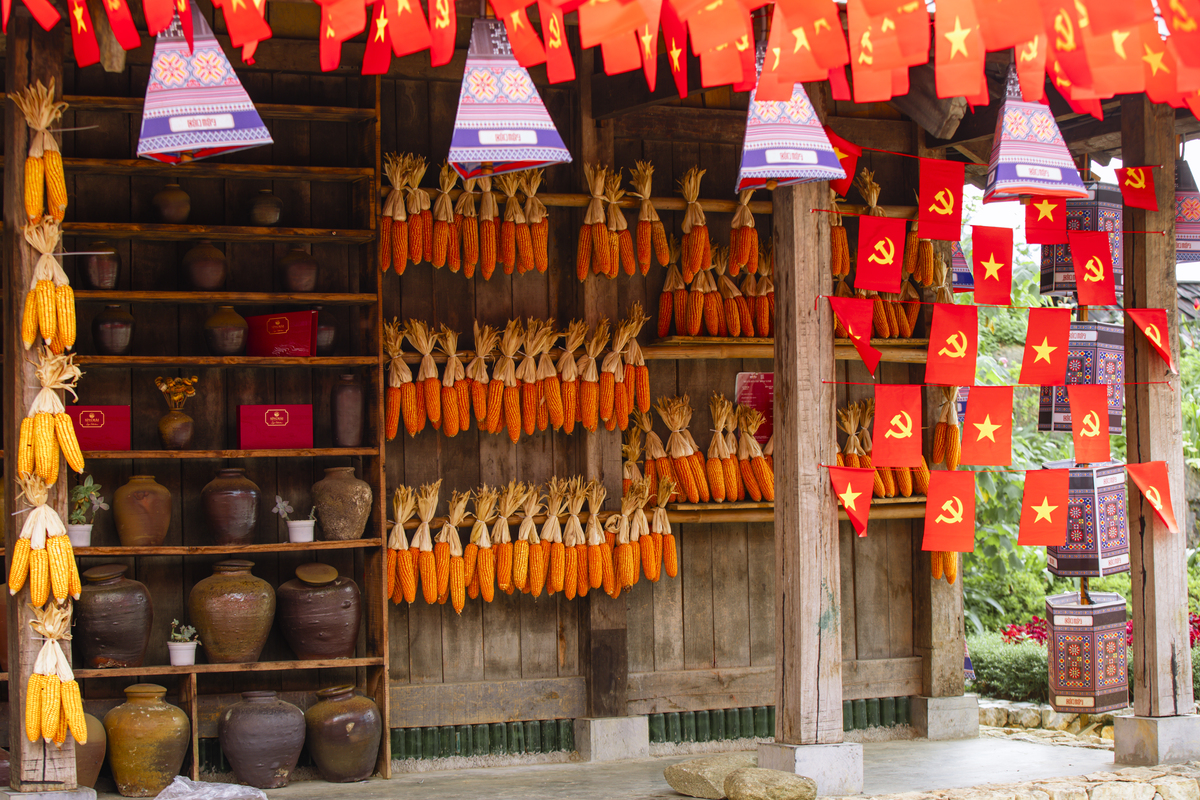
Artisans at work keep traditional skills alive in May Village. (Photo: Collected)
Surrounded by mountains and often wrapped in drifting clouds, May Village also carries a distinct sense of place. The natural setting softens the boundaries between architecture and landscape, allowing the experience to feel cohesive and continuous. It is this balance between environment and culture that gives the village its unique identity within a Sapa Vietnam map.
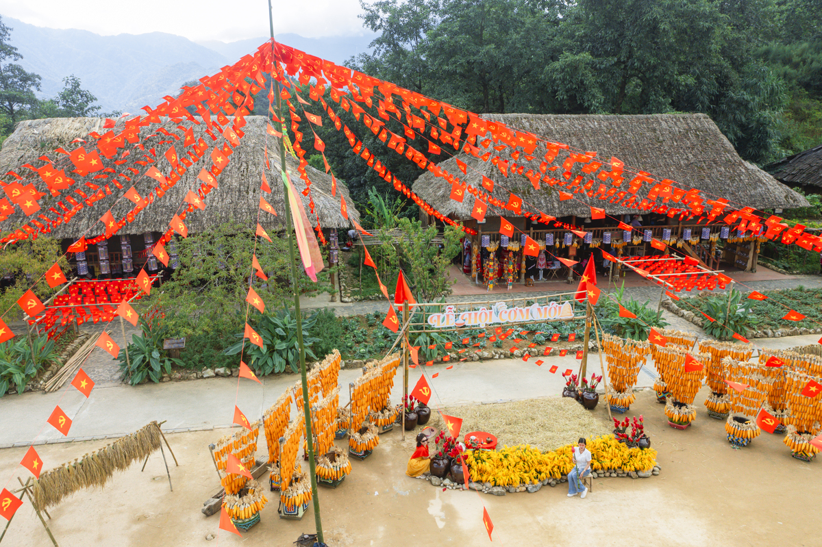
Festivals and performances bring May Village to life throughout the year. (Photo: Collected)
As part of the overall journey, May Village acts as a bridge between iconic attractions and deeper cultural exploration. It invites travelers to slow down, observe more closely, and engage with Sapa in a way that goes beyond scenery.
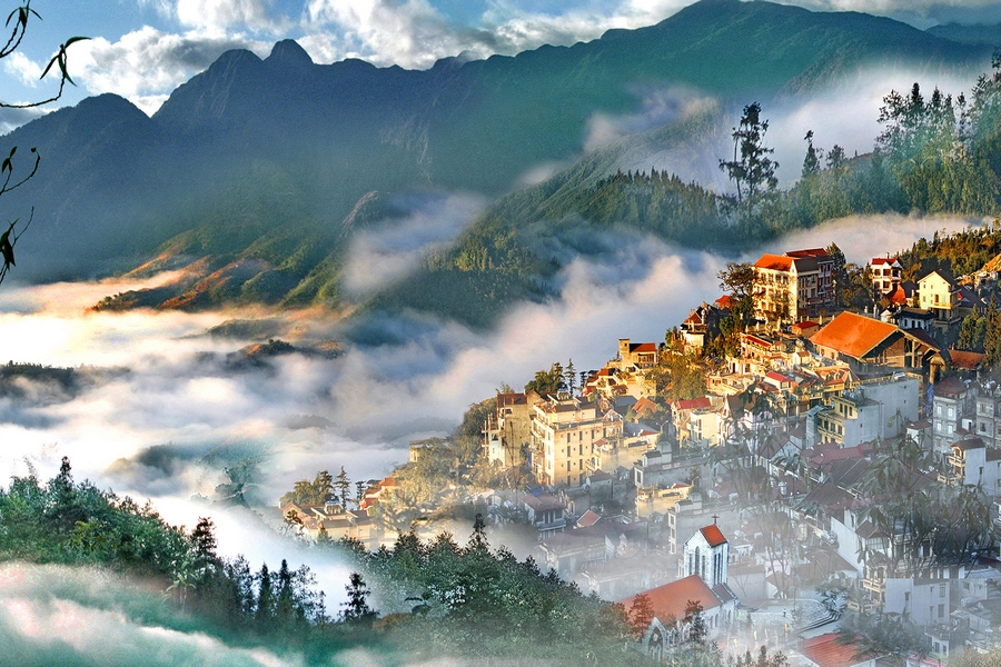
2.3 Sapa – Where culture and modern life meet
At the heart of the Sapa Vietnam map lies Sapa Commune, a compact yet dynamic area where different aspects of the destination intersect. It serves as both a starting point and a gathering space, where travelers begin to understand the rhythm of the region.

Sapa Commune blends local culture with a growing mountain destination. (Photo: Collected)
The town’s identity is shaped by its blend of old and new. The Stone Church remains a historical focal point, standing quietly amid the changing landscape. Nearby, the central square comes alive with local activities, street scenes, and cultural exchanges, especially in the evenings when the atmosphere becomes more vibrant.
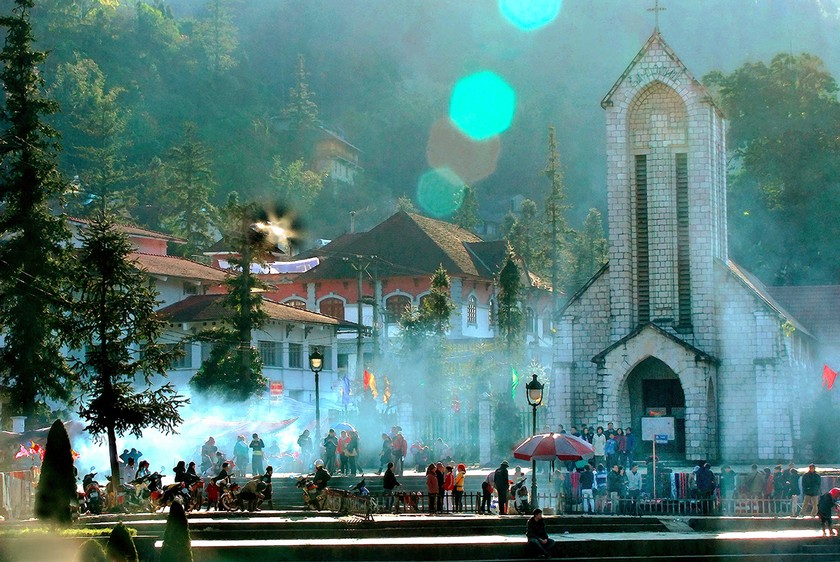
The Stone Church remains a quiet landmark at the town’s center. (Photo: Collected)
Modern elements, such as Sun Plaza with its distinctive architecture, add another layer to the experience, creating visual contrast while reinforcing Sapa’s evolving identity. Cafés, small shops, and viewpoints scattered throughout the town offer moments of pause, where travelers can take in the cool mountain air and shifting fog that defines Sapa’s mood.

Sun Plaza adds a modern contrast to Sapa’s mountain setting. (Photo: Collected)
Within a Sapa Vietnam map, Sapa Commune is not just a location, but a space where journeys begin, intersect, and unfold naturally.
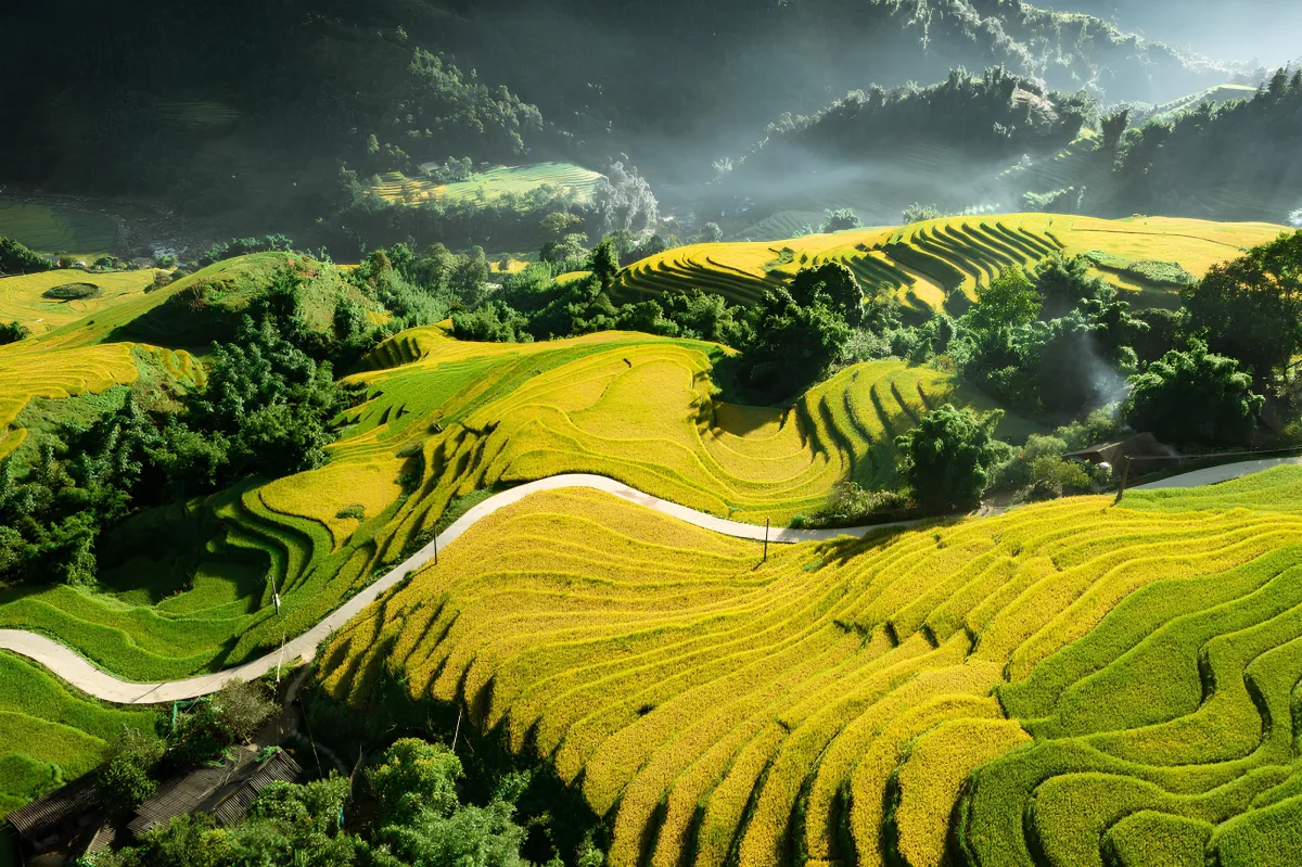
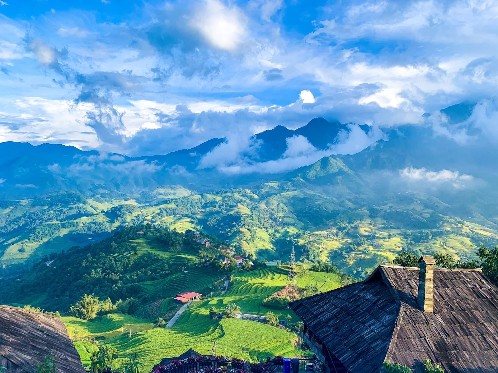
2.4 Muong Hoa Valley – The heart of terraced fields
No Sapa Vietnam map is complete without Muong Hoa Valley, an area that captures the essence of Sapa’s natural beauty. Known for its expansive terraced rice fields, the valley stretches across a landscape shaped over generations, reflecting both human effort and natural harmony.
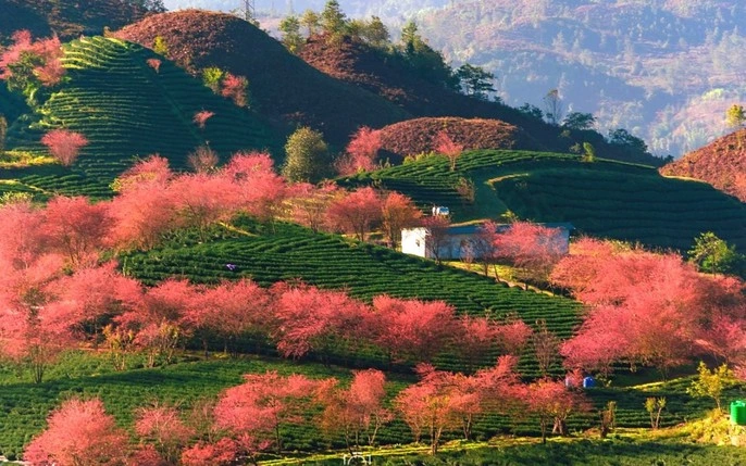
Flowers bloom across Muong Hoa Valley’s landscape. (Photo: Collected)
The scenery changes with the seasons, from vibrant green in the growing months to golden hues during harvest time. These shifts create a constantly evolving backdrop, making each visit feel distinct. Walking through the valley offers a slower, more immersive experience, where trails connect villages, streams, and viewpoints.
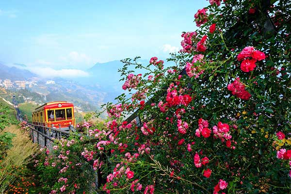
The Muong Hoa mountain train glides through the blooming valley. (Photo: Collected)
The presence of ethnic communities such as the Hmong and Dao adds cultural depth to the landscape. Their homes, daily routines, and traditional practices are interwoven with the environment, creating a sense of continuity between people and place. As part of a Sapa Vietnam map, Muong Hoa Valley represents the balance between nature and culture, offering a quieter but deeply memorable side of the journey.
2.5 Cat Cat Village – A glimpse into local life
Located just a short distance from the town center, Cat Cat Village is one of the most accessible stops on a Sapa Vietnam map, yet it still retains a strong sense of local identity. The village offers an introduction to traditional life in the mountains, shaped by the customs of the Hmong community.
Cat Cat Village offers a glimpse into Hmong life near Sapa Commune. (Photo: Collected)
Walking through Cat Cat reveals a layered landscape of wooden houses, narrow paths, and small streams flowing through the valley. Handicrafts, textiles, and local workshops provide insight into traditional skills that have been preserved over time.
While the village has become more familiar to visitors, its appeal lies in the details. The sound of water, the rhythm of daily activities, and the surrounding scenery create an atmosphere that feels grounded and authentic.
Wooden houses, streams, and crafts shape the charm of Cat Cat Village. (Photo: Collected)
Within a Sapa Vietnam map, Cat Cat Village functions as a bridge between accessibility and cultural discovery, offering a closer look at everyday life in the region without requiring extensive travel.
3. Hidden gems that complete the Sapa Vietnam map
Beyond the well-known highlights, a complete Sapa Vietnam map is shaped by quieter places that reveal a more intimate side of the region. These destinations may not always appear as the main attractions, yet they are often where the most authentic and memorable experiences unfold.
3.1 Ta Van and Lao Chai villages
Within the broader landscape of a Sapa Vietnam map, Ta Van and Lao Chai offer a deeper immersion into the rhythm of mountain life. Located along the Muong Hoa Valley, these villages are connected by trekking routes that wind through terraced fields, streams, and gently sloping hillsides.

Ta Van and Lao Chai reveal Sapa through trekking, terraces, and village life. (Photo: Collected)
What defines this area is not a single landmark, but the continuity of the experience. Walking from Lao Chai to Ta Van allows travelers to observe subtle transitions in both scenery and culture. Traditional wooden houses appear scattered across the valley, while daily activities such as farming, weaving, and livestock care unfold naturally in the background.
The presence of ethnic communities, particularly the Hmong and Giay, shapes the character of these villages. Their way of life remains closely tied to the land, and this connection is reflected in everything from agricultural practices to architectural forms. Rather than being presented as a curated attraction, the experience here feels organic and unfiltered.
From fields to wooden houses, life unfolds naturally in Ta Van Valley. (Photo: Collected)
In the context of a Sapa Vietnam map, Ta Van and Lao Chai represent the slower, more reflective side of the journey. They invite travelers to move at a different pace, where the value lies not in ticking off destinations, but in observing and understanding the landscape over time.
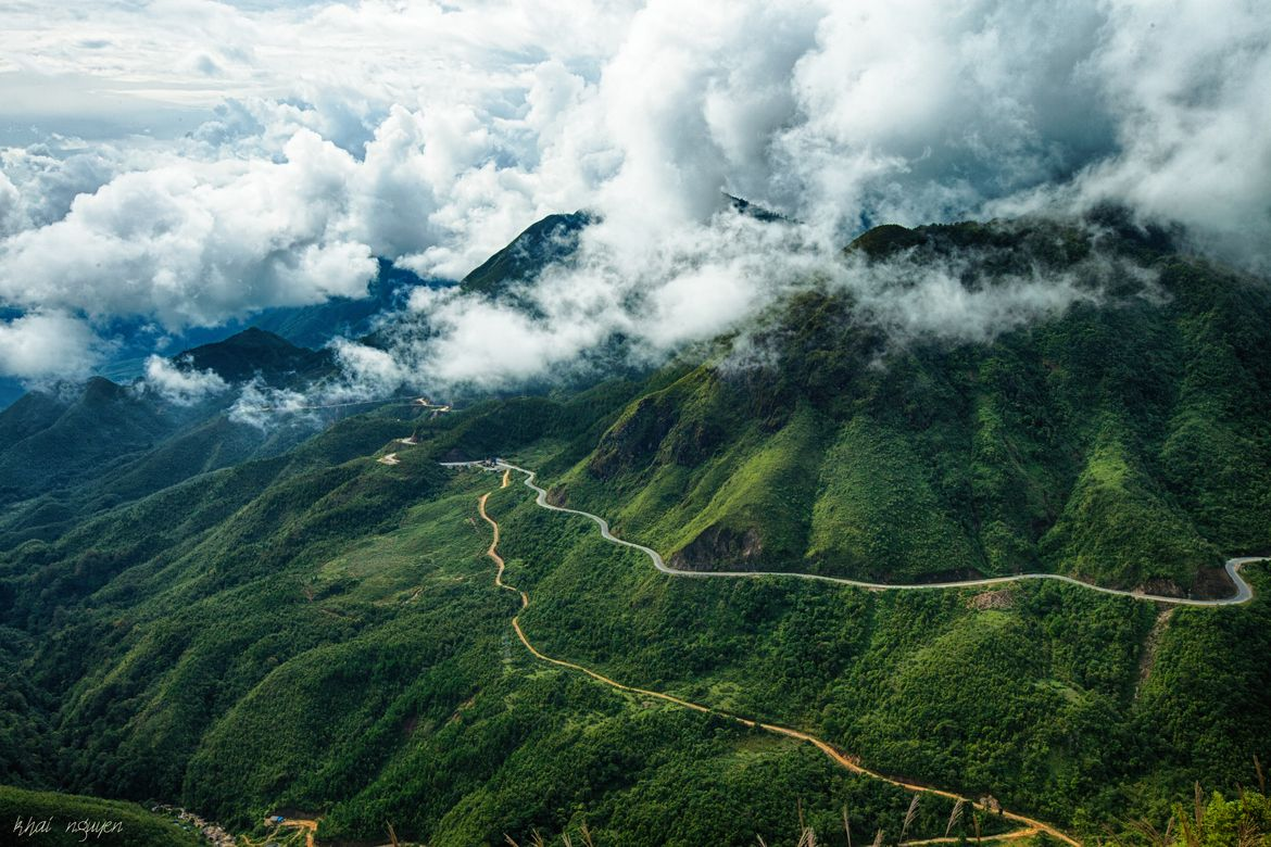
3.2 O Quy Ho Pass – One of Vietnam’s most scenic roads
On a Sapa Vietnam map, O Quy Ho Pass stands out as a route rather than a destination, yet it is one of the most visually striking experiences in the region. Stretching across the Hoang Lien Son mountain range, this pass connects Sapa with Lai Chau and offers a dramatic contrast in both terrain and climate.
The road winds through steep mountainsides, opening up to expansive views that shift with elevation. One side of the pass is often covered in mist and cool air, while the other can be warmer and clearer, creating a unique transition within a relatively short distance.
Every turn on O Quy Ho brings a new view of valleys and peaks. (Photo: Collected)
Driving or riding along O Quy Ho is less about reaching a specific point and more about the continuous unfolding of scenery. Sharp turns reveal new perspectives, from deep valleys to distant peaks layered against the horizon. Along the way, small stops and viewpoints allow travelers to pause and take in the scale of the landscape.
Within a Sapa Vietnam map, O Quy Ho Pass adds a sense of movement and contrast. It expands the journey beyond villages and landmarks, introducing a dynamic experience shaped by the terrain itself.
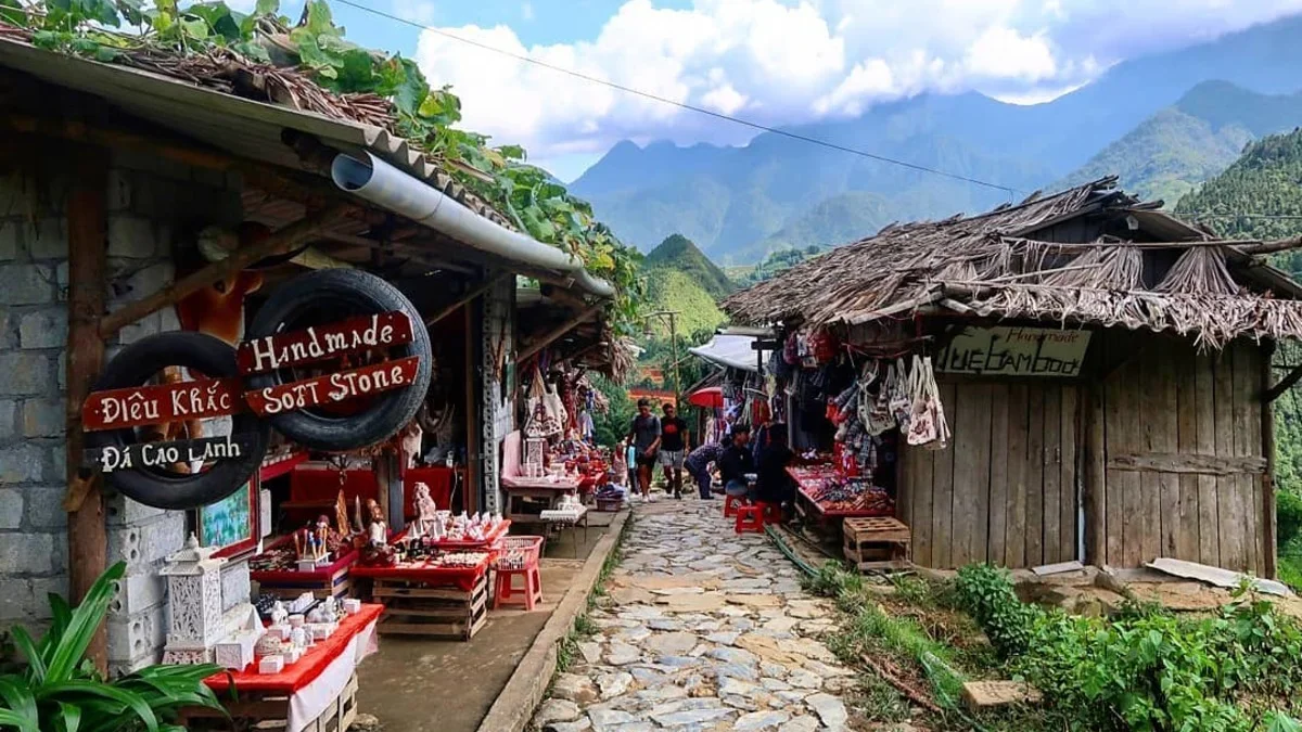
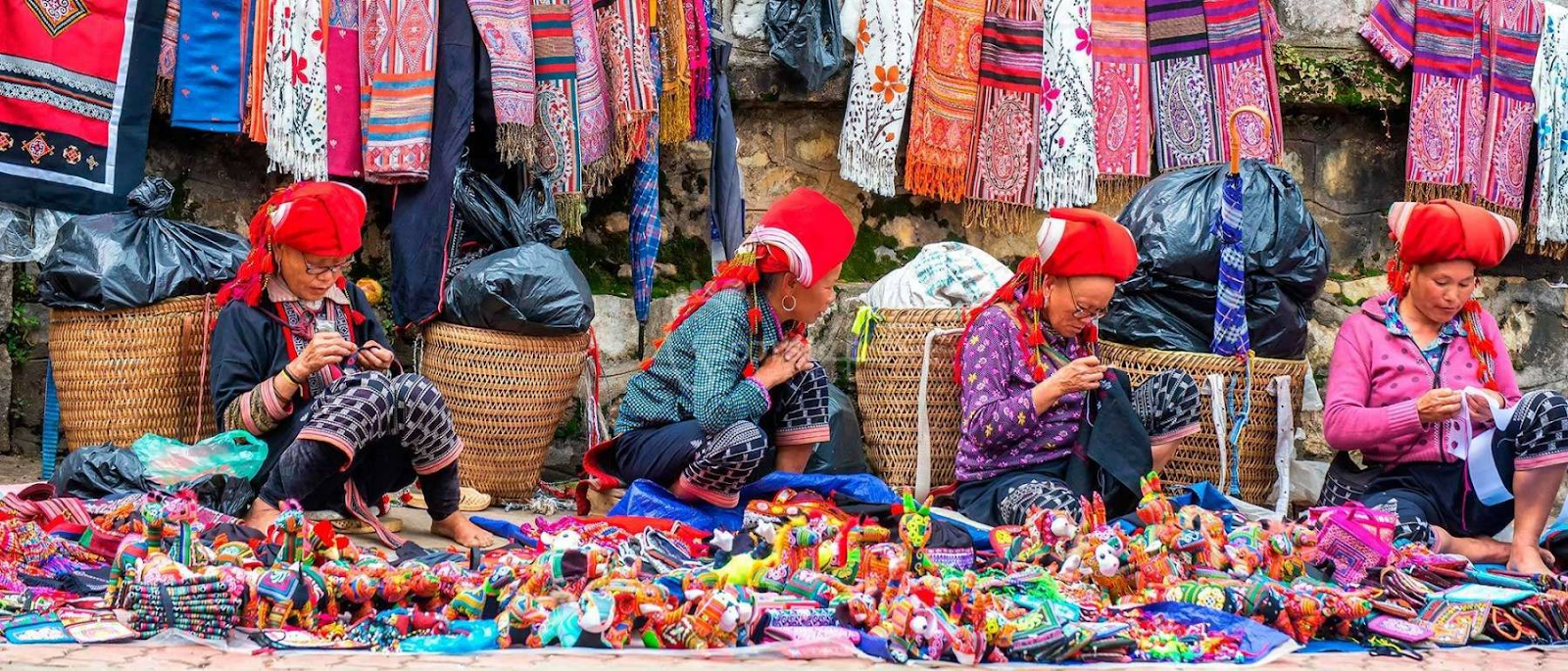
3.3 Local markets and cultural experiences
No Sapa Vietnam map is complete without the presence of local markets, where culture is expressed through everyday exchange rather than curated presentation. These markets are not only places of trade but also social spaces where different ethnic groups gather, interact, and maintain long-standing traditions.
Textiles, crafts, and food bring color to Sapa’s market scenes. (Photo: Collected)
Markets in and around Sapa often reflect the diversity of the region. Each group brings its own textiles, crafts, and agricultural products, creating a vibrant mix of colors, patterns, and textures. Traditional clothing, handmade goods, and local foods are displayed side by side, offering insight into both cultural identity and daily life.
Beyond the visual richness, the atmosphere of these markets is shaped by interaction. Conversations, bargaining, and shared routines create a sense of continuity that has been preserved over generations. For visitors, this provides an opportunity to engage more directly with local communities, moving beyond observation into participation.
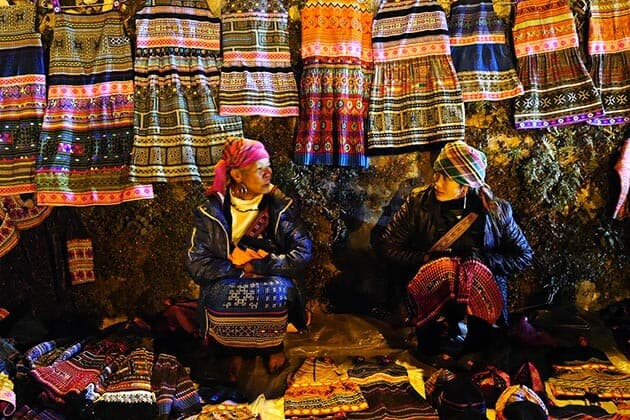
Markets connect communities through everyday exchange. (Photo: Collected)
Within a Sapa Vietnam map, local markets represent the human dimension of the journey. They connect landscapes and villages through lived experience, adding depth to the overall exploration of Sapa.
4. Tips to navigate Sapa like a local
A well-used Sapa Vietnam map is not just about knowing where to go, but understanding how to move through the region in a way that feels natural and efficient. The terrain, weather, and local rhythms all influence how each journey unfolds, making a few practical insights especially valuable.
4.1 Plan your route based on terrain, not distance
Distances on a Sapa Vietnam map can appear relatively short, but travel time often tells a different story. Mountain roads, winding passes, and changing weather conditions can significantly affect how long it takes to move between locations.

Grouping nearby spots helps create a smoother Sapa journey. (Photo: Collected)
Instead of focusing purely on distance, it is more effective to group destinations by area. For example, combining Fansipan and May Village into one day, then exploring Muong Hoa Valley, Ta Van, and Lao Chai on another, allows for a smoother and less rushed experience. This approach helps maintain a natural flow while reducing unnecessary backtracking.
4.2 Time your experiences with the weather
Weather plays a defining role in shaping the experience shown on any Sapa Vietnam map. The same location can feel entirely different depending on visibility, temperature, and season.
Morning brings the clearest skies in Sapa. (Photo: Collected)
Early mornings are often the best time for clearer views, especially for mountain peaks like Fansipan or scenic routes such as O Quy Ho Pass. Midday tends to bring more stable conditions, while late afternoons can introduce fog or shifting clouds. During the rainy season, flexibility becomes important, as sudden changes in weather may affect trekking routes or visibility.
Understanding these patterns allows travelers to adjust their itinerary in real time, making the most of each destination rather than following a fixed plan too rigidly.
4.3 Balance iconic spots with slower experiences
A common mistake when following a Sapa Vietnam map is trying to cover too many well-known attractions in a short time. While landmarks like Fansipan or Sapa Town are essential, the depth of the journey often lies in the quieter moments.
Sapa is best explored at a pace, not as a checklist. (Photo: Collected)
Balancing iconic destinations with slower experiences, such as walking through Ta Van village or spending time at a local market, creates a more complete picture of Sapa. These contrasts between movement and stillness help the trip feel less like a checklist and more like a continuous narrative.
4.4 Stay connected, but not dependent on technology
Digital maps are useful, but relying entirely on them in a mountainous region can be limiting. Signal strength may vary, especially in valleys or remote villages, which can affect navigation.
Having a general understanding of the Sapa Vietnam map, including key areas and routes, provides a stronger sense of direction even when technology is unavailable. At the same time, asking locals for guidance often leads to unexpected discoveries, from hidden viewpoints to less-traveled paths that may not appear on standard maps.