



1. Introduction to Quang Ninh on the Vietnam Tourism Map
1.1. Where Is Quang Ninh and Why Does It Have a Special Tourism Location?
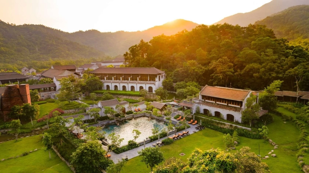
On the Vietnam tourism map, Quang Ninh is located in the Northeast, occupying a rare position as it borders China to the north while opening onto the East Sea to the east and south. With an area of more than 6,178 km², the province features a diverse landscape of high mountains, bays, and approximately 2,000 large and small islands, creating one of the country's most diverse tourism landscapes. This strategic location makes Quang Ninh a unique intersection of island and coastal tourism such as Ha Long Bay, spiritual tourism in Yen Tu, and border tourism, with convenient access from Hanoi via a modern expressway system in only about 2 hours.

Quang Ninh's diverse landscapes attract many visitors. (Source: Collected)
1.2. Why Should You Use a Quang Ninh Tourism Map Before Your Trip?
A Quang Ninh tourism map helps travelers clearly visualize destination clusters, distances, and suitable travel routes from the planning stage. With a map, sightseeing routes such as Ha Long – Co To, approximately 60 km by water, or the Northeast loop through Mong Cai – Tra Co – Hai Ha become easier to arrange and more time-efficient. Combining digital maps with travel applications also allows travelers to proactively choose destinations according to the season, avoid getting lost, and optimize transportation costs, resulting in a more complete and flexible experience.
1.3. Key Tourism Areas on the Quang Ninh Map
Quang Ninh tourism maps are generally divided into five main destination clusters to make planning easier. At the center is Ha Long Bay – Bai Chay, where the UNESCO heritage site and vibrant tourism services are concentrated. To the Northeast is Bai Tu Long Bay, with the pristine island and sea landscape of Van Don; farther out is the Co To – Quan Lan cluster, known for white sandy beaches and clear blue waters.
To the west is Yen Tu – Uong Bi, associated with spiritual tourism amid mountainous landscapes, while the Mong Cai – Tra Co area features the distinctive character of border tourism along Vietnam's longest coastline. These destination clusters are conveniently connected by expressways, making them suitable for a 3- to 5-day journey to explore Quang Ninh.
2. Map of Quang Ninh's Outstanding Coastal and Island Destinations
2.1. Ha Long Bay on the Tourism Map
On the Quang Ninh tourism map, Ha Long Bay is the most prominent destination and has been recognized by UNESCO as a World Natural Heritage Site. The entire bay features approximately 1,969 limestone islands and islets, creating a spectacular landscape of rare beauty. Frequently marked attractions on the map include Sung Sot Cave, with its massive stalactite system, and Ti Top Island, which features a beach and a mountain summit offering panoramic views of the bay.
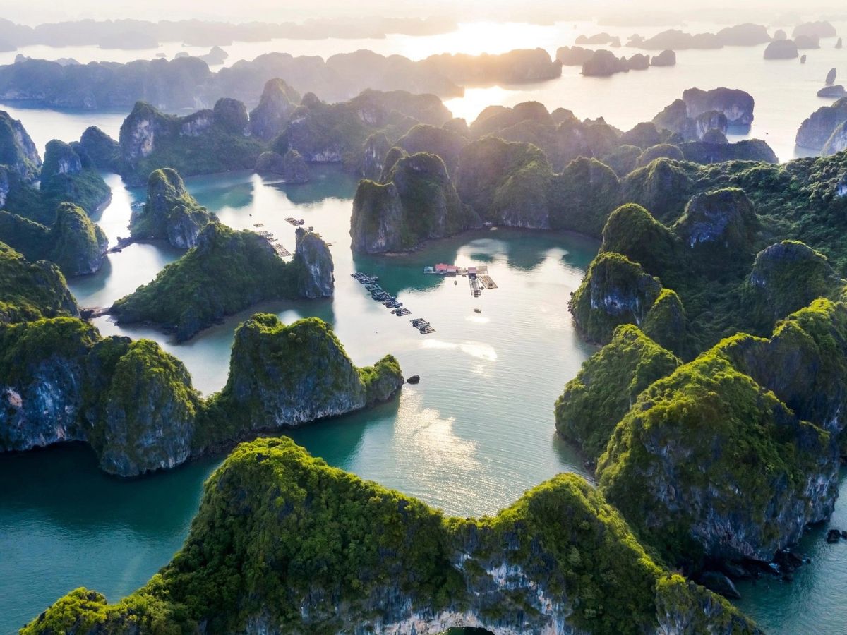
Ha Long Bay is a world natural wonder that attracts many visitors. (Source: Collected)
In addition to the natural island system, the Ha Long area map also clearly shows modern entertainment destinations such as Bai Chay, with an artificial beach nearly 5 km long, and Sun World Ha Long, home to the Queen Cable Car crossing the sea and a large-scale entertainment complex. Tuan Chau Island is marked as the main departure port for 1- to 3-day bay cruise tours, with options ranging from standard cruises to 4- to 6-star luxury cruises, making it easier for travelers to plan a complete exploration of Ha Long Bay.
2.2. Bai Tu Long Bay and Its Pristine Island and Sea Landscape
On the Quang Ninh tourism map, Bai Tu Long Bay lies northeast of Ha Long Bay, in the Van Don area. The area features more than 600 large and small islands while retaining its tranquil beauty and experiencing less impact from mass tourism. Commonly marked destinations include Ngoc Vung Island, with its pristine beach and traditional fishing village, and Quan Lan Island, known for its stretches of fine white sand and refreshing resort atmosphere.
The bay map also clearly shows boat routes departing from Ao Tien Port – Van Don, providing convenient access to Luon Cave, smaller bays, and connections to neighboring areas such as Lan Ha Bay – Cat Ba. With fewer visitors than Ha Long, Bai Tu Long Bay is suitable for 2-day-1-night or 3-day-2-night trips for travelers who enjoy pristine islands and beaches, slow-paced relaxation, and authentic nature experiences.
2.3. Famous Islands on the Quang Ninh Tourism Map
In the Northeast area of the Quang Ninh tourism map, Co To Island and Quan Lan Island are two prominent destinations for summer coastal and island tourism. Co To impresses visitors with Hong Van Beach, known for its calm waters and fine sand, as well as Co To Lighthouse, which stands more than 100 m above sea level and offers a 360-degree panoramic view of the island. Quan Lan, meanwhile, attracts visitors with its long coastal road, Minh Chau – Son Hao beaches, and a fishing village atmosphere that retains its traditional character.
These islands are connected to the mainland by high-speed boats from Van Don, with an average travel time of about 1.5 hours, making them convenient for 2- to 3-day itineraries. On the map, accommodation options such as homestays, mini hotels, camping areas, and night seafood markets are also clearly marked, helping travelers easily choose where to stay and where to buy fresh seafood. These are ideal destinations for enjoying the blue sea, white sand, and fresh air of Quang Ninh during the peak coastal tourism season.
3. Map of Cities and Inland Tourist Attractions
3.1. Ha Long City as a Tourism Service Hub
On the Quang Ninh tourism map, the coastal city of Ha Long is located in the southern part of the province and serves as the largest hub for accommodation, entertainment, and tourism services. With an area of more than 1,100 km² and a well-developed transportation system, Ha Long is home to numerous hotels and high-end resorts such as Wyndham and Novotel, as well as Bai Chay Beach, which stretches for nearly 5 km, making it convenient for vacations and family trips. It is also the main transit point for tours of Ha Long Bay.
The Ha Long map also highlights iconic attractions such as Sun World Ha Long, a large-scale entertainment complex featuring the Queen Cable Car crossing the sea, the Sun Wheel, and a bayside amusement park. In addition, the Quang Ninh Museum, with more than 30,000 historical and cultural artifacts, the vibrant Ha Long Night Market, and seafood food streets make it easy for visitors to combine sightseeing, entertainment, and experiences of modern coastal urban life.
3.2. Uong Bi and the Yen Tu Spiritual Tourism Area
On the Quang Ninh tourism map, Uong Bi is located about 35 km southwest of Ha Long and serves as an important gateway to the Yen Tu spiritual tourism area. The city is closely associated with Yen Tu Mountain, the center of Vietnamese Truc Lam Buddhism, where a system of ancient pagodas and towers blends with a sacred mountain landscape. Its location near the expressway makes Uong Bi easily accessible from Hanoi and neighboring areas.
The Yen Tu complex is prominently marked on the map with attractions such as Hoa Yen Pagoda, Dong Pagoda at the 1,068 m-high mountain summit, Mo Stream, and a modern cable car system nearly 2.1 km long, helping shorten travel time for pilgrims. Every year, especially during the spring festival season, the area welcomes millions of visitors who combine worship, mountain trekking, and eco-retreats, creating a distinctive tourism character for Uong Bi.
3.3. Mong Cai and Tra Co
In the far Northeast on the Quang Ninh tourism map, Mong Cai – Tra Co is an area strongly characterized by border and coastal tourism. Located about 150 km from Ha Long via the expressway, Mong Cai stands out as an international border-gate city where Vietnamese and Chinese cultures and commerce intersect. On the map, the area is marked with a system of border gates, border markets, and coastal tourism routes.
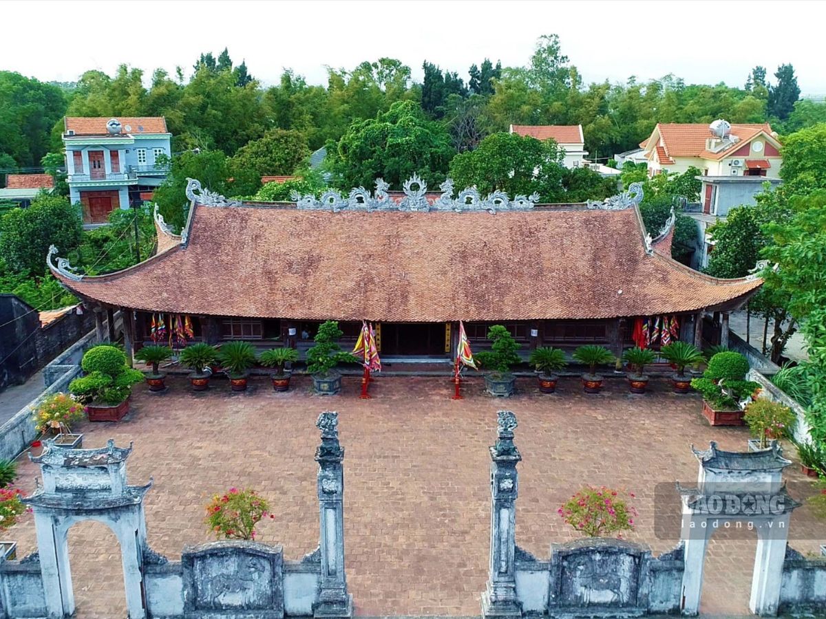
Tra Co is a highlight on the Quang Ninh tourism map. (Source: Collected)
Tra Co is an important highlight, featuring a beach approximately 17 km long, considered one of the longest and most pristine beaches in Northern Vietnam. Attractions such as Sa Vi Cape, the easternmost point of Vietnam, the historic Tra Co Communal House, and coastal fishing villages create an experience that combines both nature and culture. The Mong Cai – Tra Co area is well suited to a 3-day tour from Ha Long, allowing visitors to explore the coast while experiencing the border trade environment and distinctive local seafood cuisine.
>>> Explore Now Hai Ha, Quang Ninh Travel with Unique New Experiences
4. Suggested Itineraries Based on the Quang Ninh Tourism Map
4.1. 3-Day-2-Night Itinerary Along the Ha Long Route: Exploring Islands and Entertainment
For first-time visitors to Quang Ninh, the Ha Long route is a practical choice when looking at the tourism map. On the first day, spend the entire day exploring central Ha Long, visiting Bai Chay, the Quang Ninh Museum, and Sun World Ha Long, with its sea-crossing cable car, amusement park, and panoramic check-in spots overlooking the bay. In the evening, you can stroll through the night market, enjoy seafood, and relax in the Bai Chay area.

Enjoying Sun World Ha Long with thrilling rides and exciting experiences. (Source: Collected)
On the second day, travelers can follow the bay route clearly marked on the map to explore Ha Long Bay by half-day or full-day cruise, visiting highlights such as Sung Sot Cave, Ti Top Island, and fishing villages. If you do not take a bay cruise, you can choose a nearby island such as Tuan Chau for swimming and relaxation. The final day is suitable for shopping for local specialties and enjoying local cuisine before heading home, making the 3-day-2-night journey compact while still offering a complete experience.
👉 BOOK QUEEN CABLE CAR TICKETS HERE!
4.2. Itinerary for Families and Groups of Friends
For families with young children or large groups of friends, a Quang Ninh tourism map helps prioritize destinations that are easy to reach and require fewer changes of transportation. The itinerary should focus on Ha Long – Bai Chay, where infrastructure is well developed, accommodation options are diverse, and there are many safe entertainment activities such as beaches, parks, and indoor entertainment areas. Alternating relaxation with sightseeing helps prevent members of the group from becoming tired, making it particularly suitable for older travelers.
For younger groups of friends, the tourism map allows for greater flexibility, combining Ha Long with nearby islands or experiences such as light trekking, cruises, and seaside bars. The itinerary can be adjusted according to the weather and visitor density, prioritizing shorter travel routes to save time. By following the map, travelers can easily choose an itinerary that suits their needs, allowing them to enjoy activities and relaxation without becoming overwhelmed.
5. Tips for Using the Quang Ninh Tourism Map Effectively
For scientific trip planning, travelers should combine paper maps with digital maps. A paper map helps visualize the overall destination clusters across the province and identify main travel routes such as Ha Long – Yen Tu – Mong Cai. Meanwhile, digital maps such as Google Maps and Quang Ninh travel applications provide real-time information on traffic conditions, boat piers, parking areas, and accurate travel distances, which is especially useful when exploring islands and coastal areas or traveling independently.
In addition, it is important to choose the right time for each area and remain flexible when adjusting the itinerary. Summer is ideal for coastal and island destinations such as Ha Long and Co To; spring is suitable for spiritual tourism in Yen Tu; while autumn and winter are more appropriate for exploring cities, visiting museums, and enjoying resort stays.

Travelers should plan ahead and use the tourism map effectively to explore Quang Ninh. (Source: Collected)
The Quang Ninh tourism map is an important tool that helps travelers proactively build an itinerary suited to their available time, preferences, and travel season. By understanding the locations of destinations ranging from coastal and island attractions to spiritual sites and entertainment venues, the trip becomes more organized, cost-effective, and complete. Whether traveling independently or with a family group, using a tourism map helps visitors explore this heritage-rich region flexibly, efficiently, and with a wealth of experiences.